The land of ice and fire, where volcanoes meet glaciers!
Another old trip, this time from 2013, but certainly one of my favorites. To be honest I’m not sure if I want to tell you about it because there’s already way too many tourists over there and I’m concerned about the impact on the environment.

In case you’re wondering there’s not actually that much ice in Iceland, at least during the short summer. On the other hand the weather is rather unpredictable and can change very quickly so be prepared for that. Outside of the short summer you will obviously get a lot of snow.
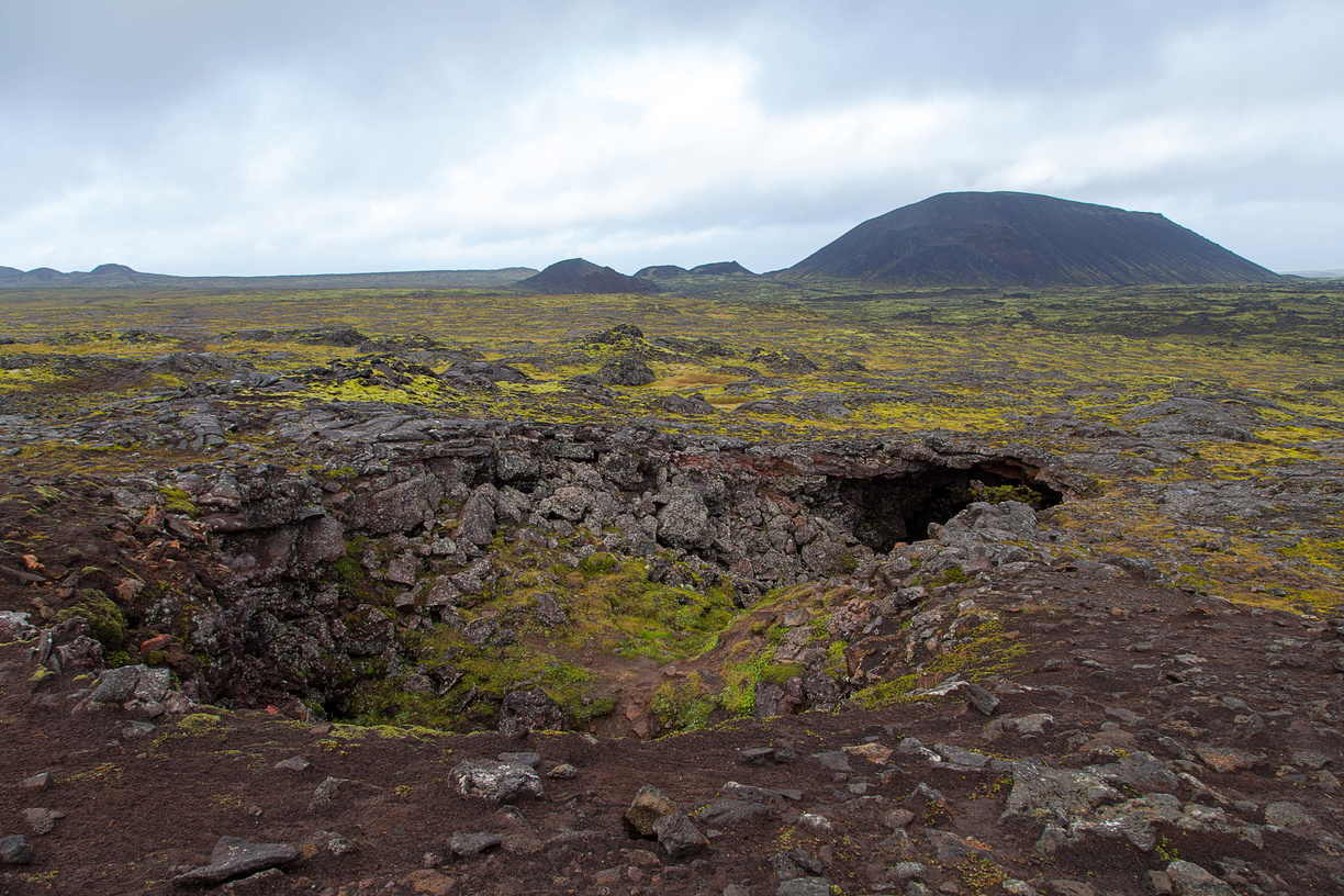
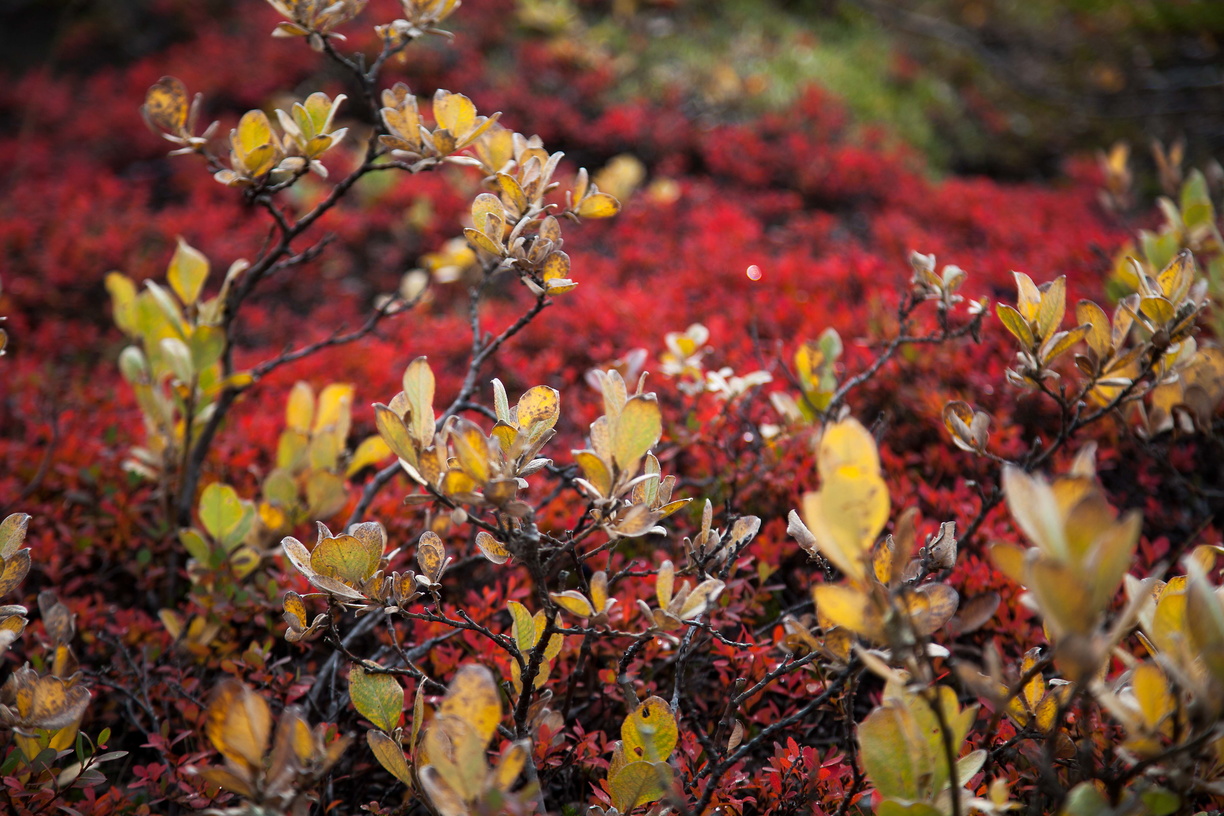
Iceland is actually pretty diversified: there are of course glaciers and volcanoes but also green moss fields, lava fields, black sand beaches, brightly coloured geothermal areas and a lot of waterfalls. What you won’t often see however is trees. There’s really not a lot of forests in Iceland.
The good news is that it’s hard to get lost on the road even without a GPS: Road 1 circles the whole island so just follow that and you’ll be fine… as long as you don’t mind driving on gravel roads. Outside of Road 1 there’s also a lot of F-roads which are restricted to 4WD vehicles. Don’t even think of driving off-road: the vegetation grows very slowly so that would do a lot of damage and get you a big fine if you get caught.
So why is there one main road going in a circle? Well Iceland has a population of only 300.000 people with 100.000 in the capital Reykjavik alone. The rest of the settlements are spread all along the coast since the centre of the island is pretty much uninhabitable, being made of glaciers and volcanoes. As a matter of fact you won’t even find and F-road crossing through the centre, the only way is around.
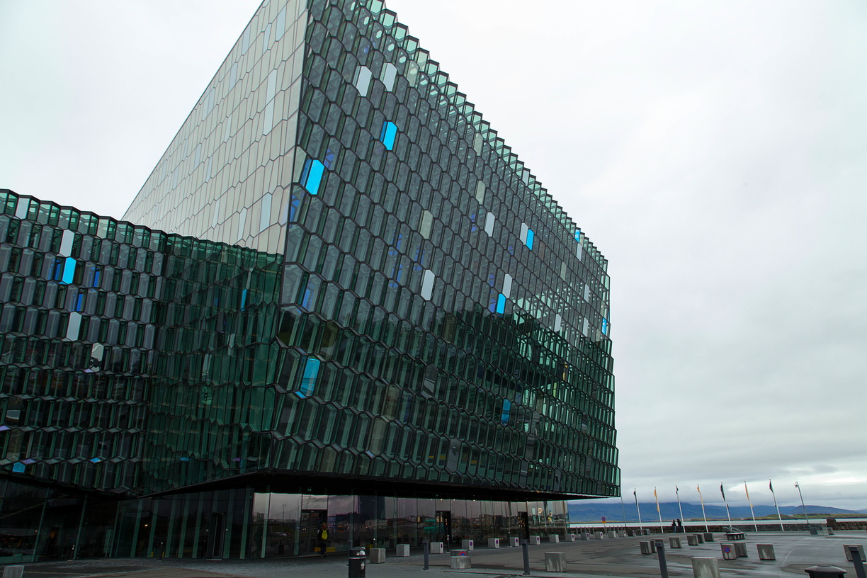
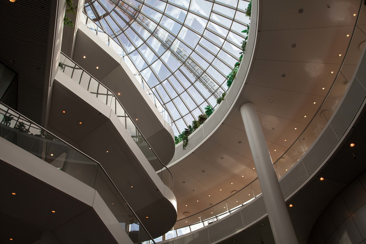
 Let’s start with Reykjavik: it’s a small but modern city, as you can see from the pictures of the Concert Hall:
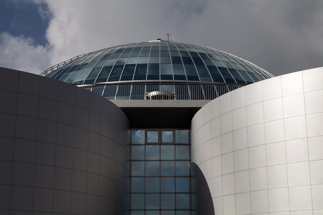
 and of the Perlan, which used to be hot water storage tanks but now houses expos, shops and a museum. It also offers a nice view over Reykjavik:
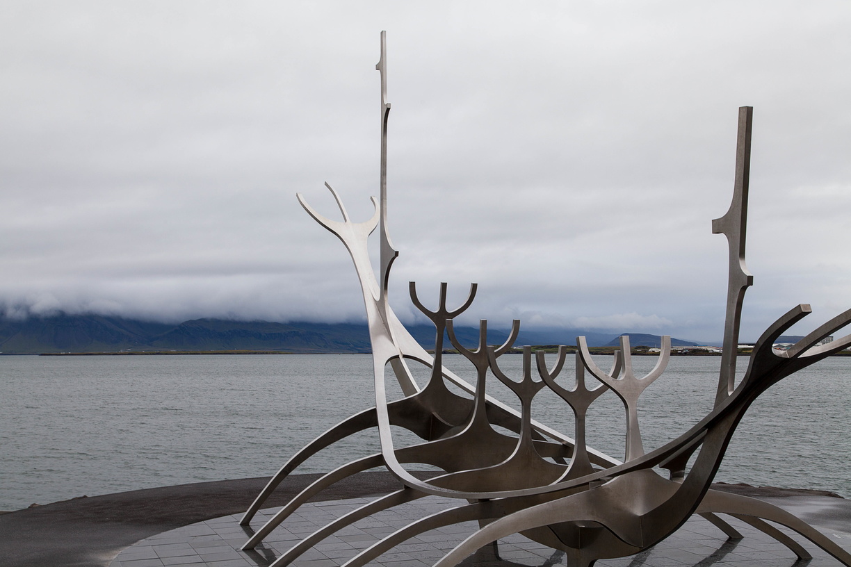
 As demonstrated by the ship sculpture above the Icelanders are proud of their Viking heritage, particularly of figures such as Leif Erikson who discovered the Americas long before Christopher Colombus and has his own statue in front of the Reykjavik church.
Speaking of Viking heritage, one Icelandic oddity is the fact that they use patronymic or matronymic surnames. Meaning that instead of family names they take the name of father or mother with the suffix -son (for men) or -dottir (for women). It’s a good thing their population is so small because it makes it hard to know if you’re related to a stranger or not.
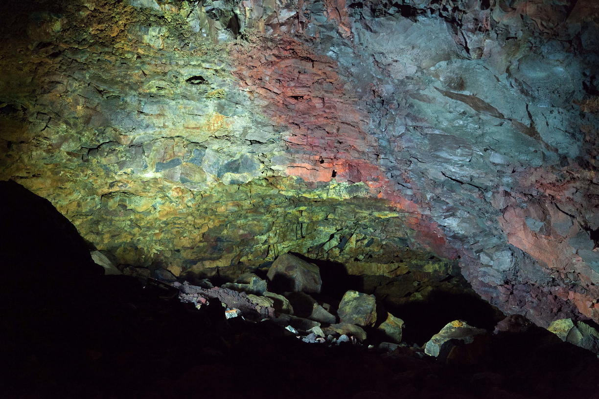
 Moving on: my first excursion was in the Thrihnukagigur volcano. Yes, in the volcano, the magma chamber more precisely. The volcano is obviously dormant and so the magma chamber is empty which allows us to see all the bright colours inside.
But before that you’ll have to go on a moderate 45 minutes hike to the crater. Since this is Iceland I highly suggest good hiking shoes and rainproof gear.
Once at the base camp you’ll be lowered into the magma chamber through the crater aboard a cable lift (the same kind used to wash the windows of skyscrapers).
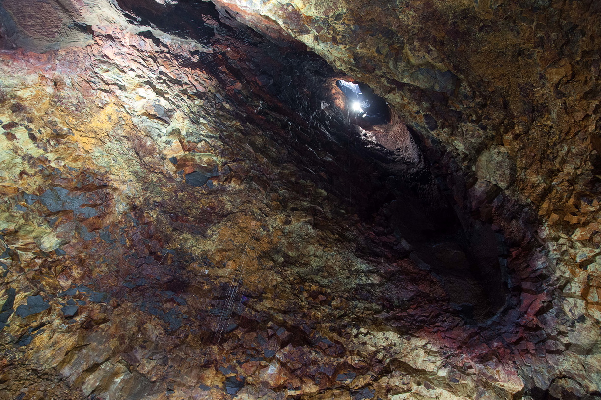 The magma chamber is quite big: about twice the height of the Reykjavik church. As you see there’s a lot of colours here and the shaft of light dropping from above coupled with the water drops falling from the ceiling give it a wonderful atmosphere.
There are also some dark fissures that may or may not hide Lovecraftian creatures lurking below. You’ll have plenty of time to think about that once the cable lift leaves you at the bottom.
 The rest of the trip will follow Road 1, counter-clockwise, all around the island. The few next points compose what is called the Golden Circle, a relatively small area not far from Reykjavik and full of wonderful sights.
The first one of those being Geysir which gave its name to the geysers. This is very clearly a geothermal area: you can see water vapour coming from the ground, bubbles forming in ponds, the smell of sulphur is in the air and of course there are geysers.
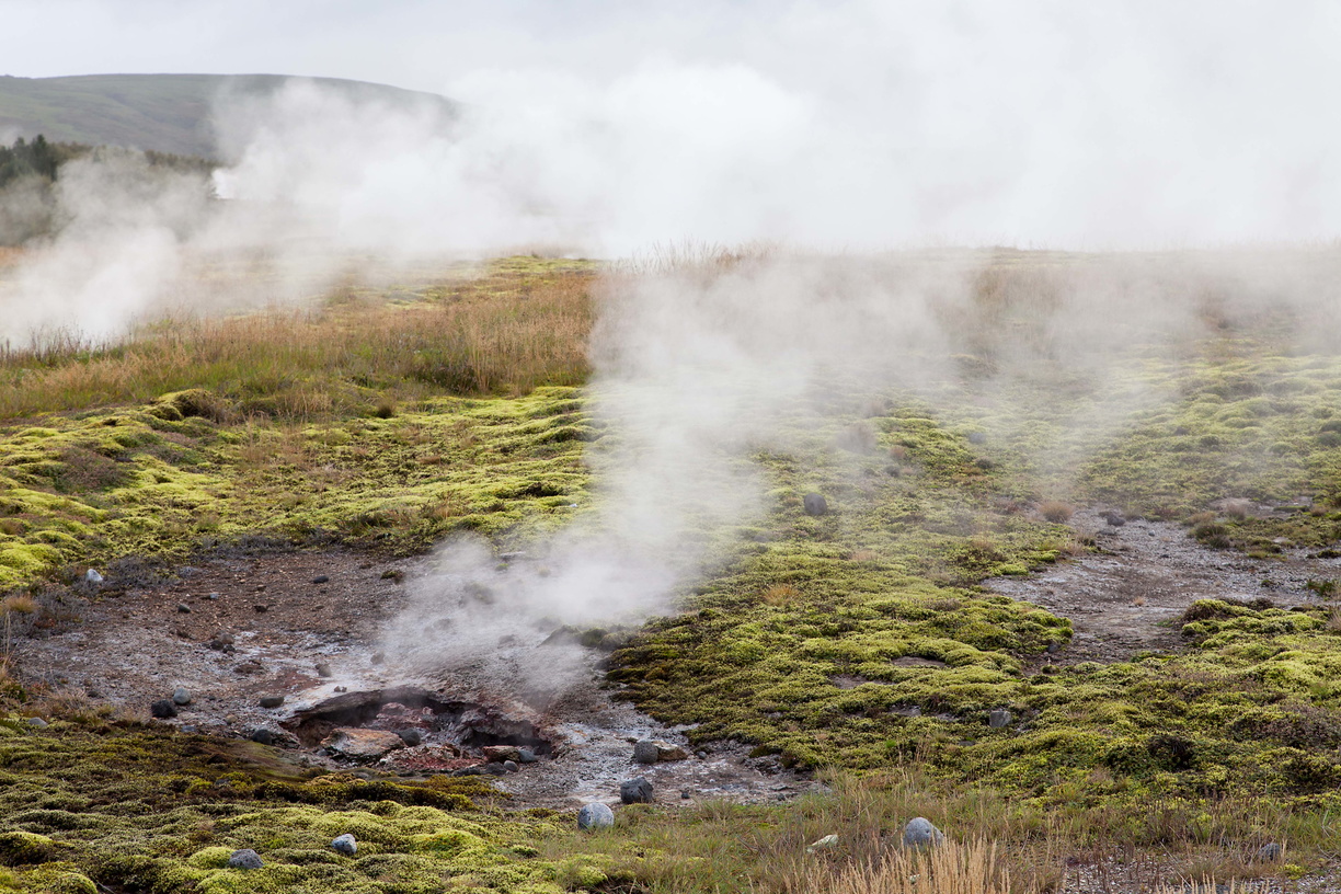 Not Geysir itself mind you: you can see it but it almost never erupts anymore, its little brother Strokkur however gives a show every few minutes.
Around this area you will also see more of the bright geothermal colours, both on the ground and in the water.
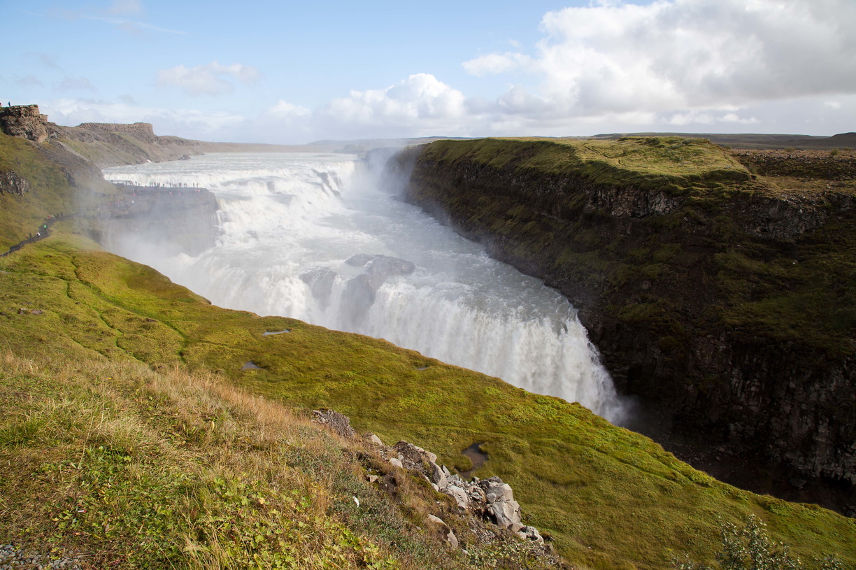
Next we have the beautiful and impressive Gullfoss waterfall. You can’t miss it: simply follow the noise and the mist.
 Still in the Golden Circle we have Thingvellir which, although quite beautiful on its own, also holds cultural significance since it was the site of the first Icelandic Parliament.
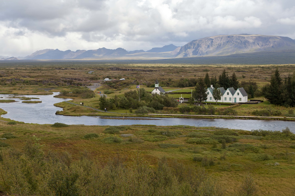 Located in Thingvellir is the Silfra rift which marks the separation between the North American and the Eurasian tectonic plates and is also a scuba diving spot with very clear water (I’ll have to go back for that).
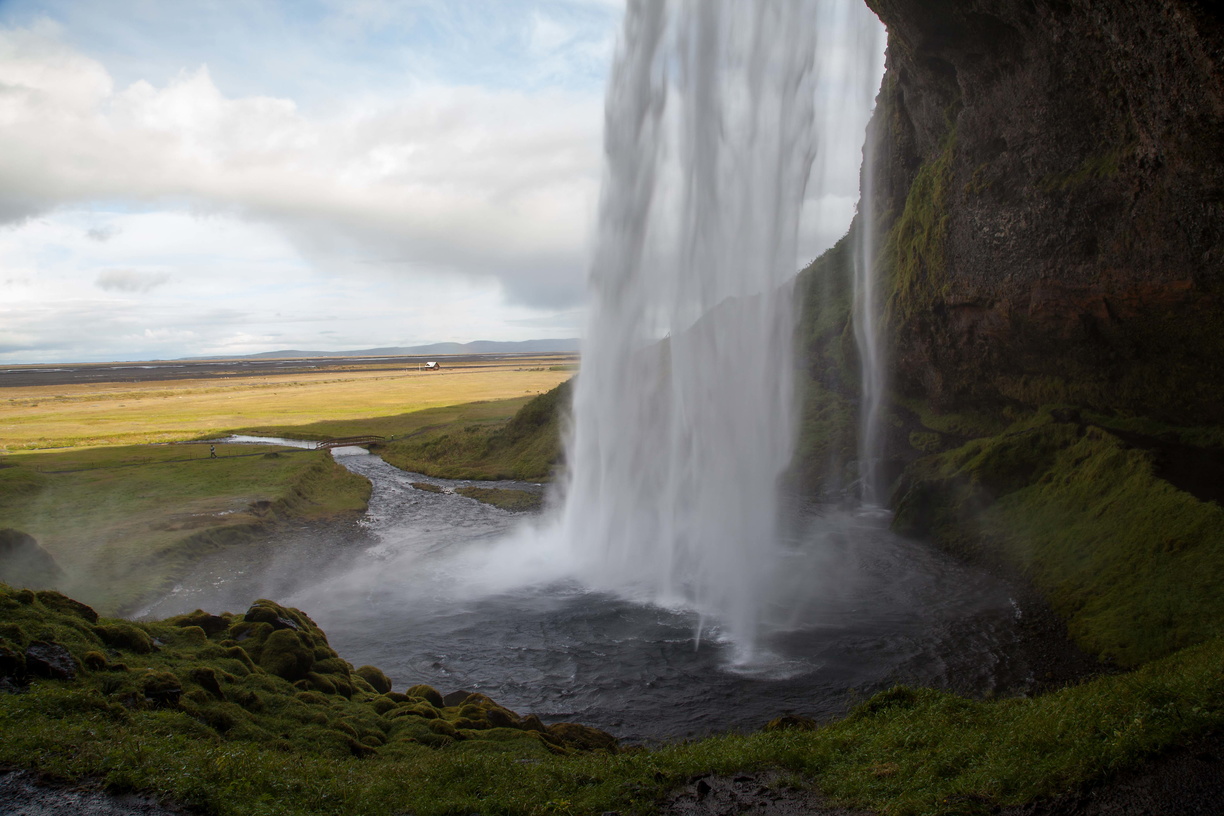 Leaving the Golden Circle, we continue with the Seljalandsfoss and Skogafoss waterfalls. In case you’re wondering: yes, most Icelandic names are basically impossible to pronounce and you’ve not even seen the worst ones yet.
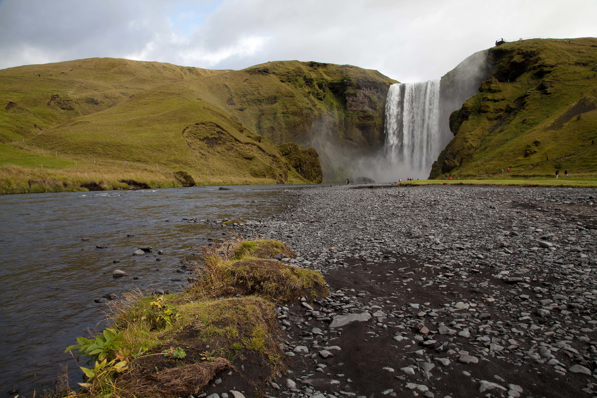 Iceland has clearly one thing in common with Norway: there are waterfalls everywhere. But in my opinion Iceland wins because the waterfalls are all quite different from each other.
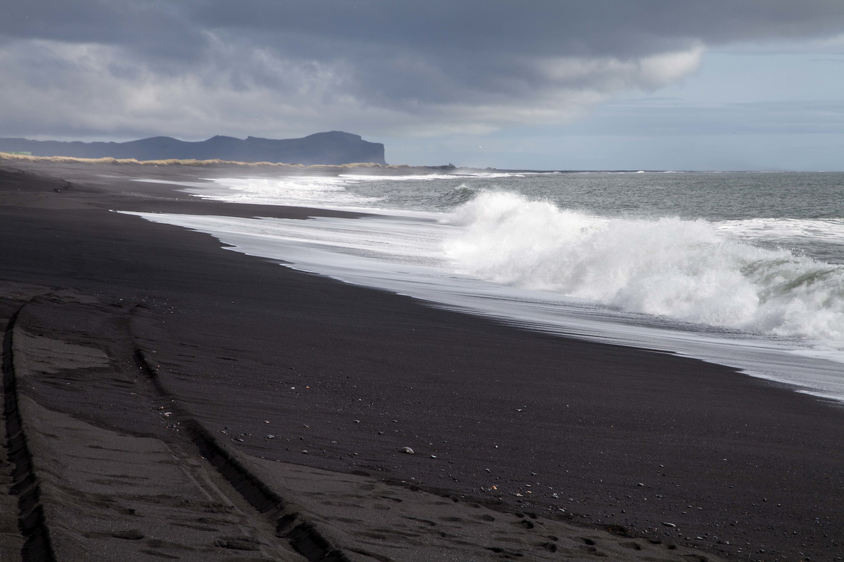
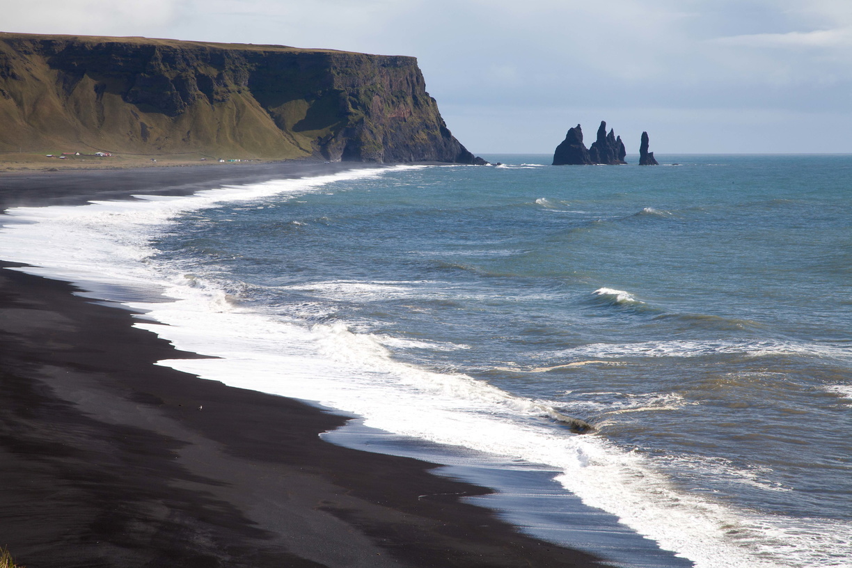 Now we get to our first black sand beaches at Dyrholaey and Vik. If you’re thinking that black sand is weird and ugly I can assure you it’s not. Those beaches are magnificent and the atmosphere changes completely depending on if it’s sunny or cloudy.
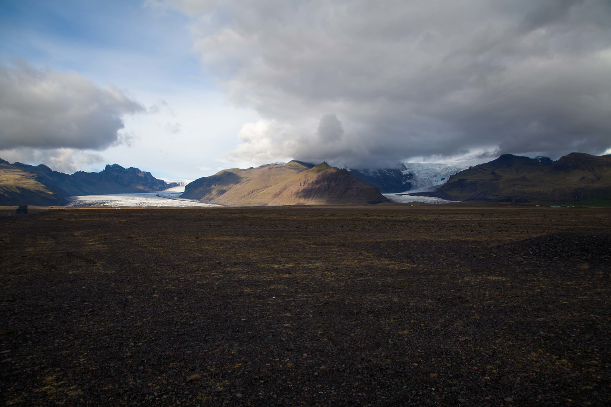
 Continuing our trip, we cross an enormous empty plain leading us to our first glacier: Svinafellsjokull at the Skaftafell National Park.
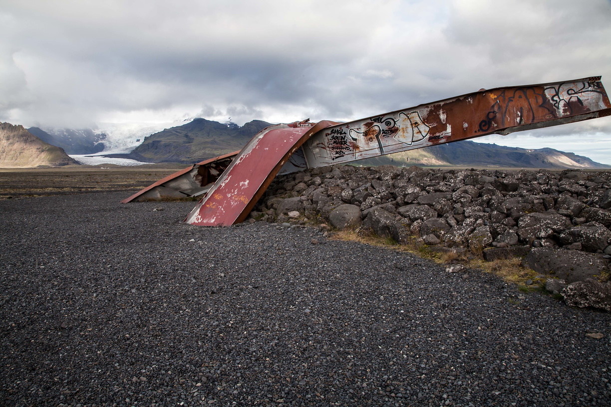
 Along the road we can see the remnants of a bridge washed away by the flood waters caused by a volcanic eruption, left there to remind us that nothing is permanent in those parts.
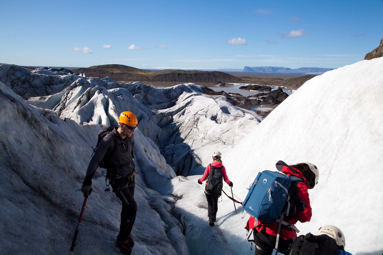
 On the next day I went hiking on the glacier. It’s definitely worth it to see what a glacier looks like from up close.

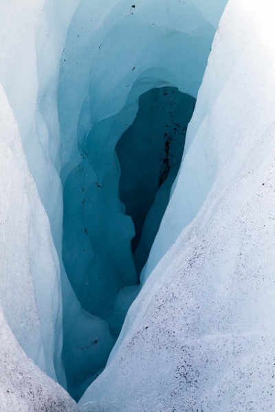 It is interesting the different types of fissures, the traces of ash that give it a black colour, the small rivers formed by melting water (that is drinkable and quite refreshing by the way).
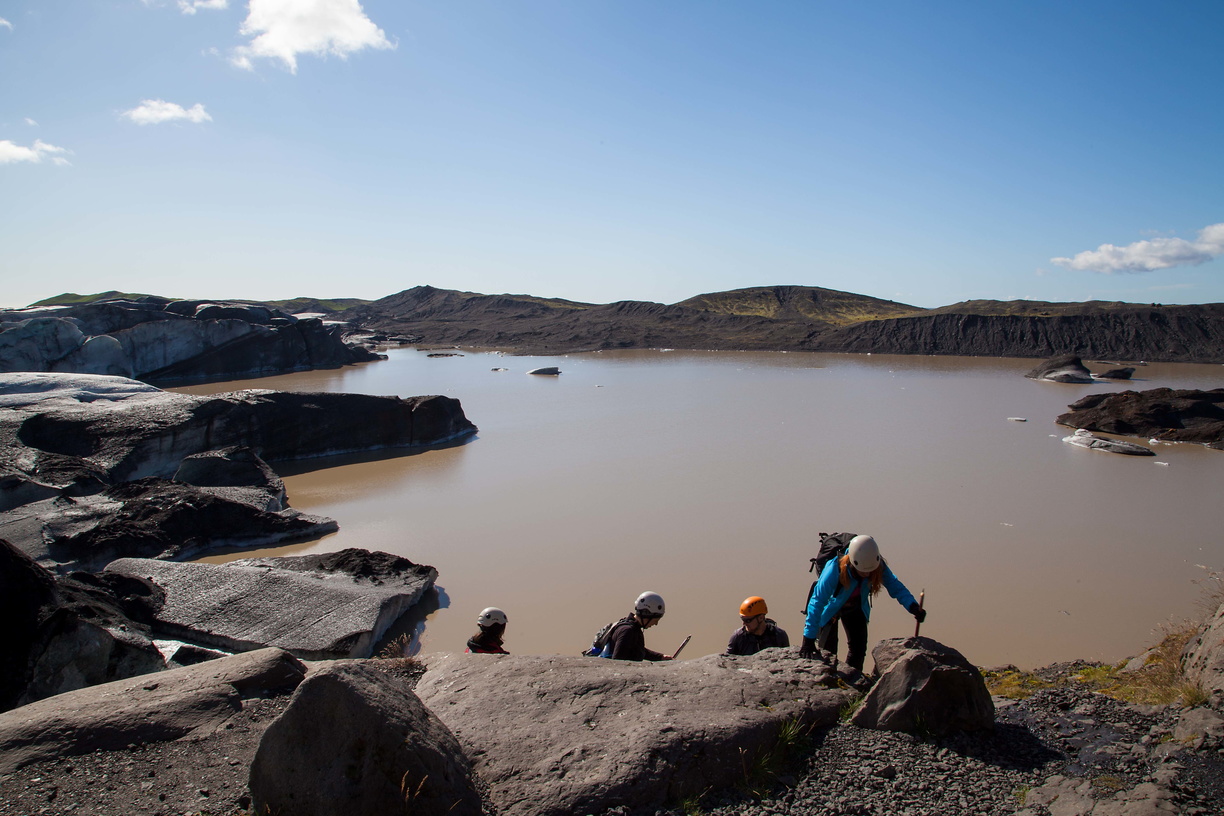
 The sad part are the signs showing how far the glacier has retreated due to global warming (about 200m at the time, as you can see on the picture below). As a matter of fact our guide told us that they have to push back the starting point of those hikes every year.
 After the glacier I went on another hike in the Saftafell National Park, which gives a nice view over the plain below and leads to the Svartifoss waterfall.
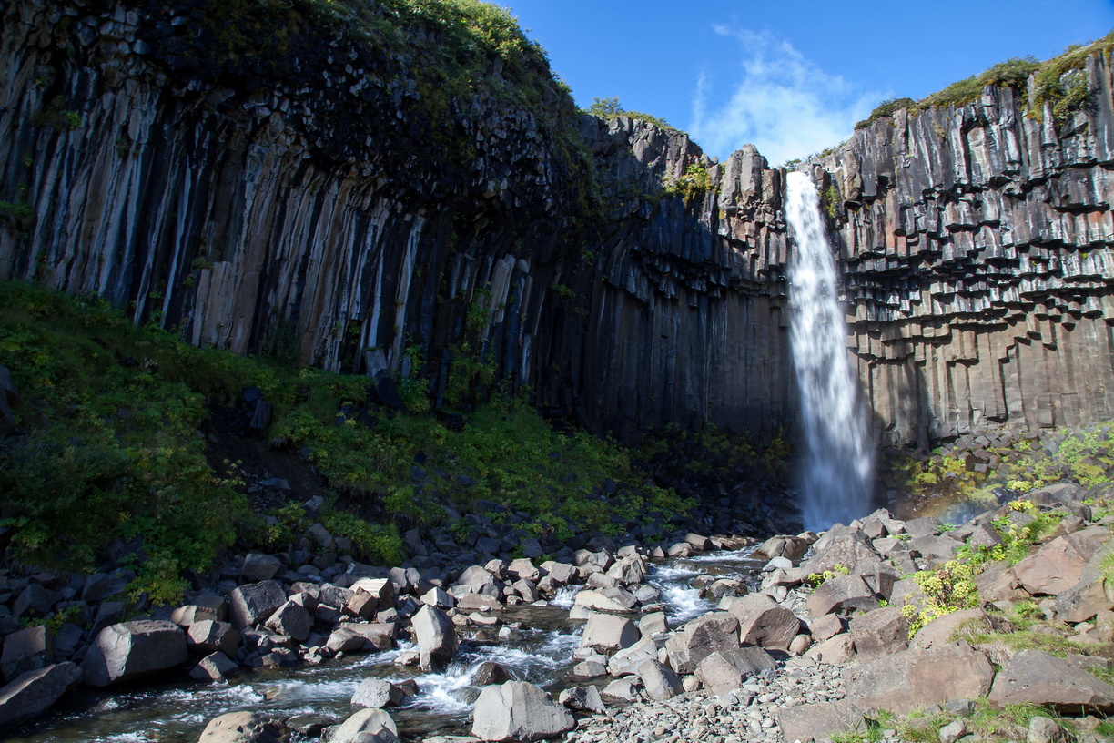 The main feature of this one is that it falls among basalt columns, the same kind you’ll see on the Giant’s Causeway (more on that in a future post over Ireland).
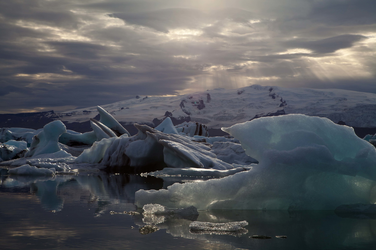
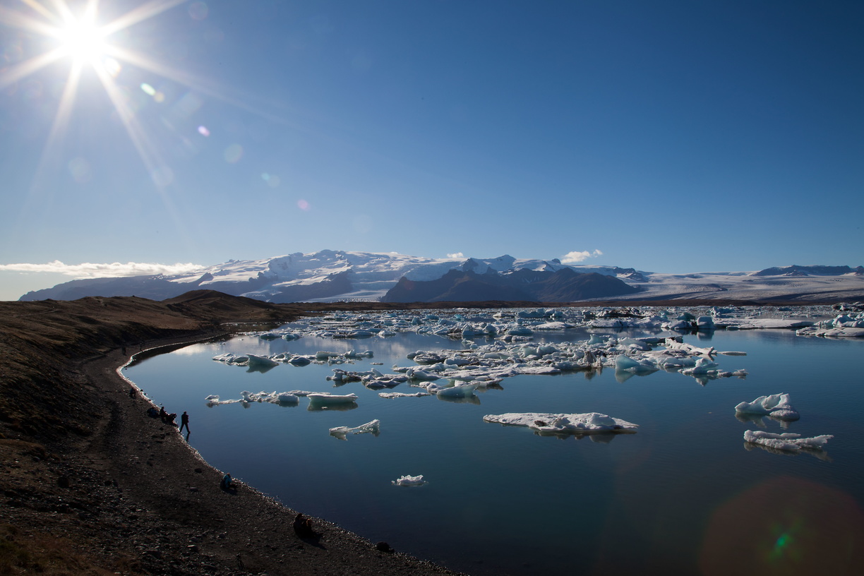 The next part is where I got really lucky. I was driving to my next stop, the Jokulsarlon lagoon, and I got there in the late afternoon just as the sun was beginning to set.
Most tourists had already left so the place was almost empty and really quiet. So quiet that you could hear the gentle sound of water touching the shore and iceberg drifting, I had never seen a place so peaceful.
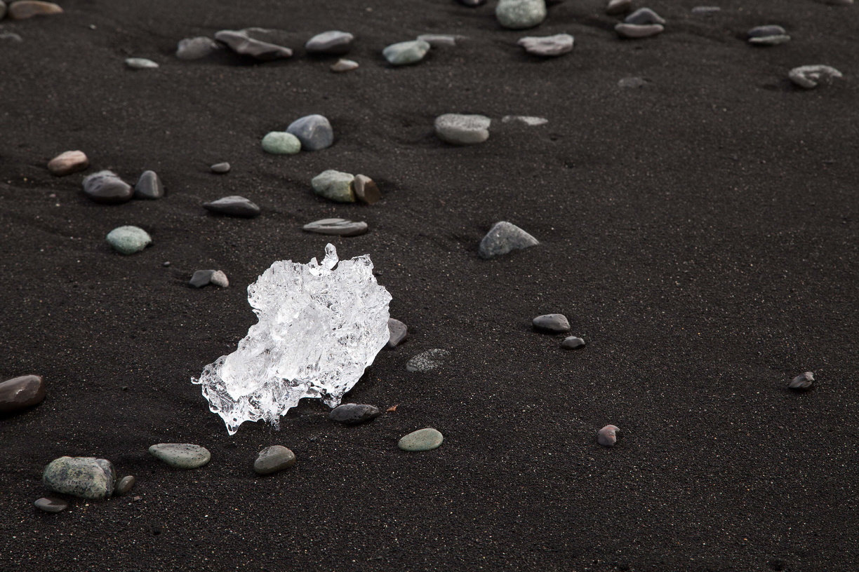
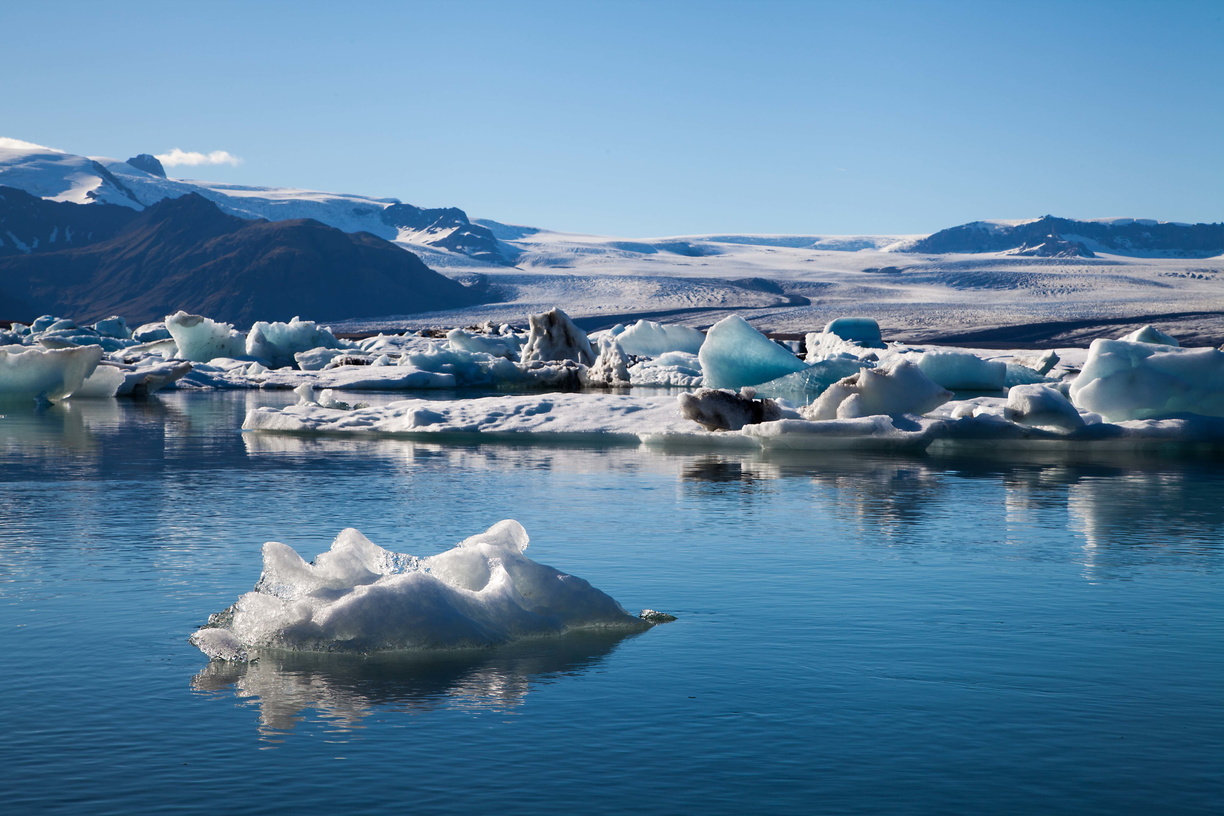 Jokulsarlon is a lagoon located at the bottom of a glacier and connected to the sea, however it is not quite salt water because it comes from the melting ice of the glacier and that water flows towards the sea. The lagoon is full of icebergs that have broken off from the glacier and are slowly drifting to the sea. Some of those then end up on the black sand beach, which gives some nice pictures.
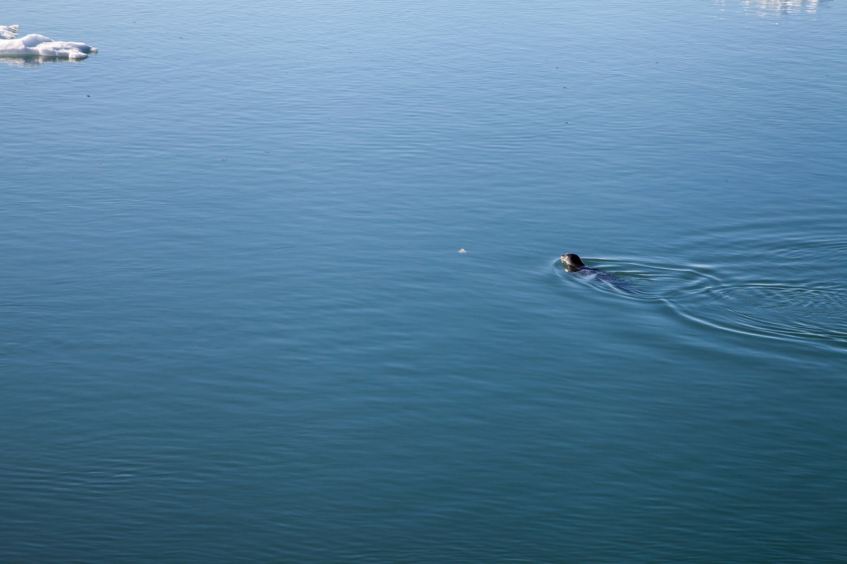
 There are even ducks and seals living in the lagoon!
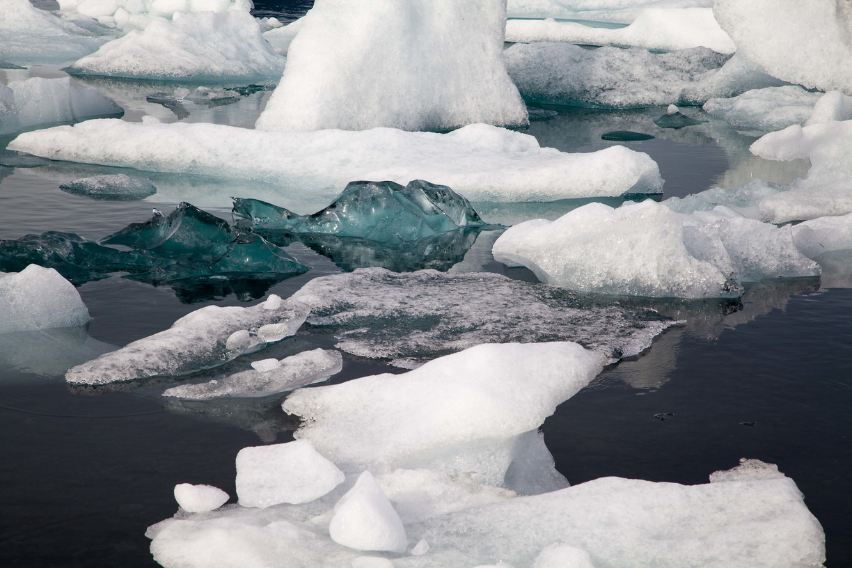
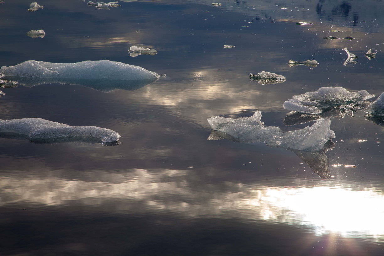
 On the next day I went on a boat tour of the lagoon where you go among the icebergs. Those are often quite big and keep moving, sometimes even flipping over. You can also see that there are different colours of ice, depending on how densely the ice was packed when it was in the glacier.
 Once again I got very lucky with the weather and managed to get some wonderful pictures during sunset.
 Fun fact: you remember that scene in Tomorrow Never Dies where there’s a car chase on ice? That was actually filmed over Jokulsarlon. The glacier melts in part because of the salt from seawater so they cut off the lagoon from the sea to allow it to freeze during winter.
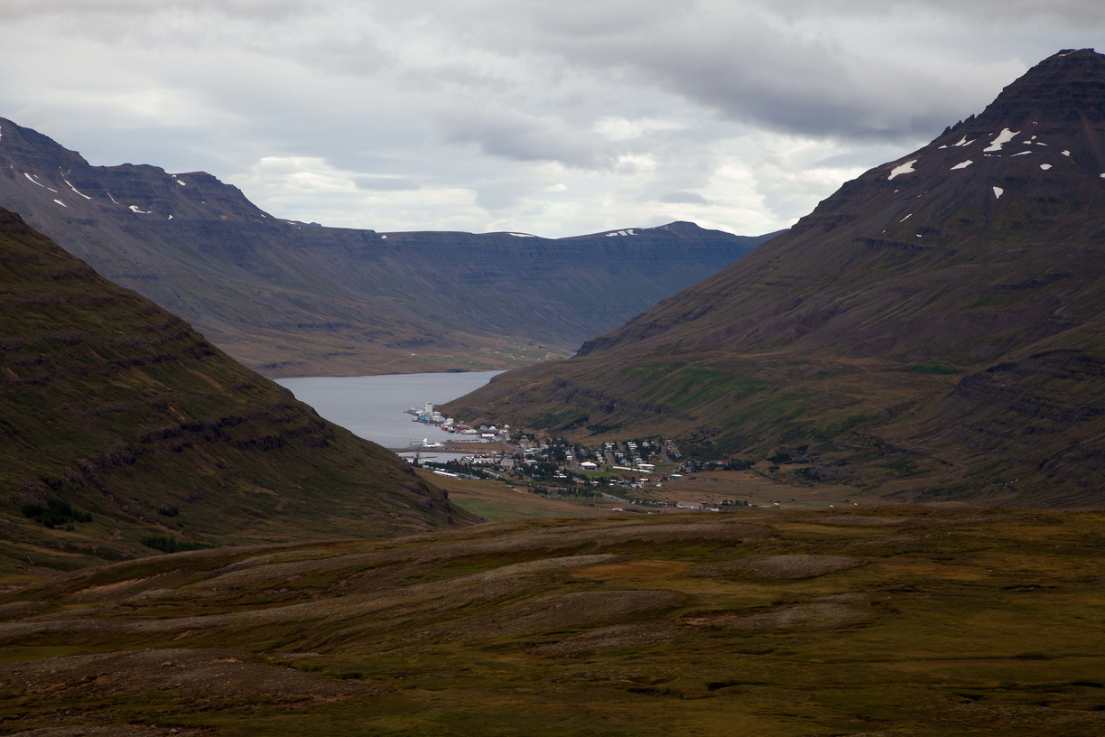 After that I kept going east, passing some more waterfalls, then we start seeing the first fjords. Keep in mind that the best ones are in the Westfjords on the other side of the island but I didn’t have time to see that part of the country.
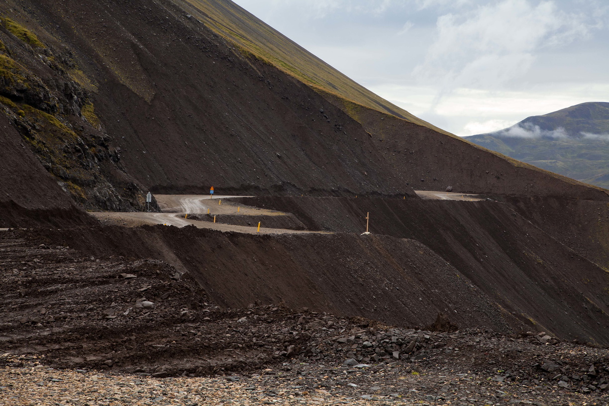 It was still nice but some roads are really quite frightening. As you can see here these are gravel roads, they’re not wide and there’s nothing stopping from falling down the slope and into the sea. Luckily it was daytime and the weather was dry, I can’t imagine driving there at night in the rain (I only had a regular car by the way, no 4WD). Oh and don’t even think about changing your mind and going back, there’s not enough space to turn a car around.
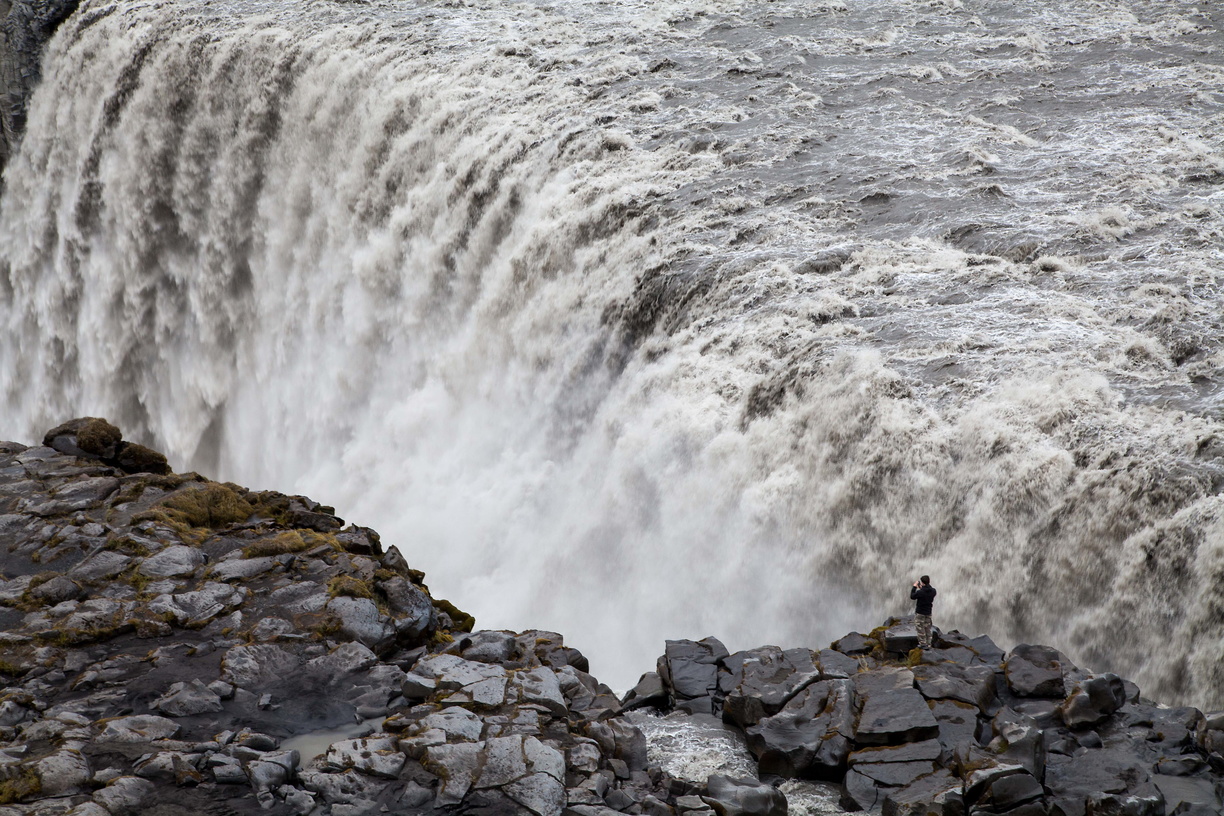
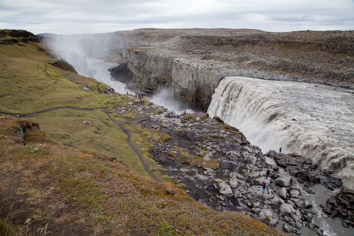 The Ring Road then starts taking us north and on the way we’ll see Europe’s largest waterfall: Dettifoss.
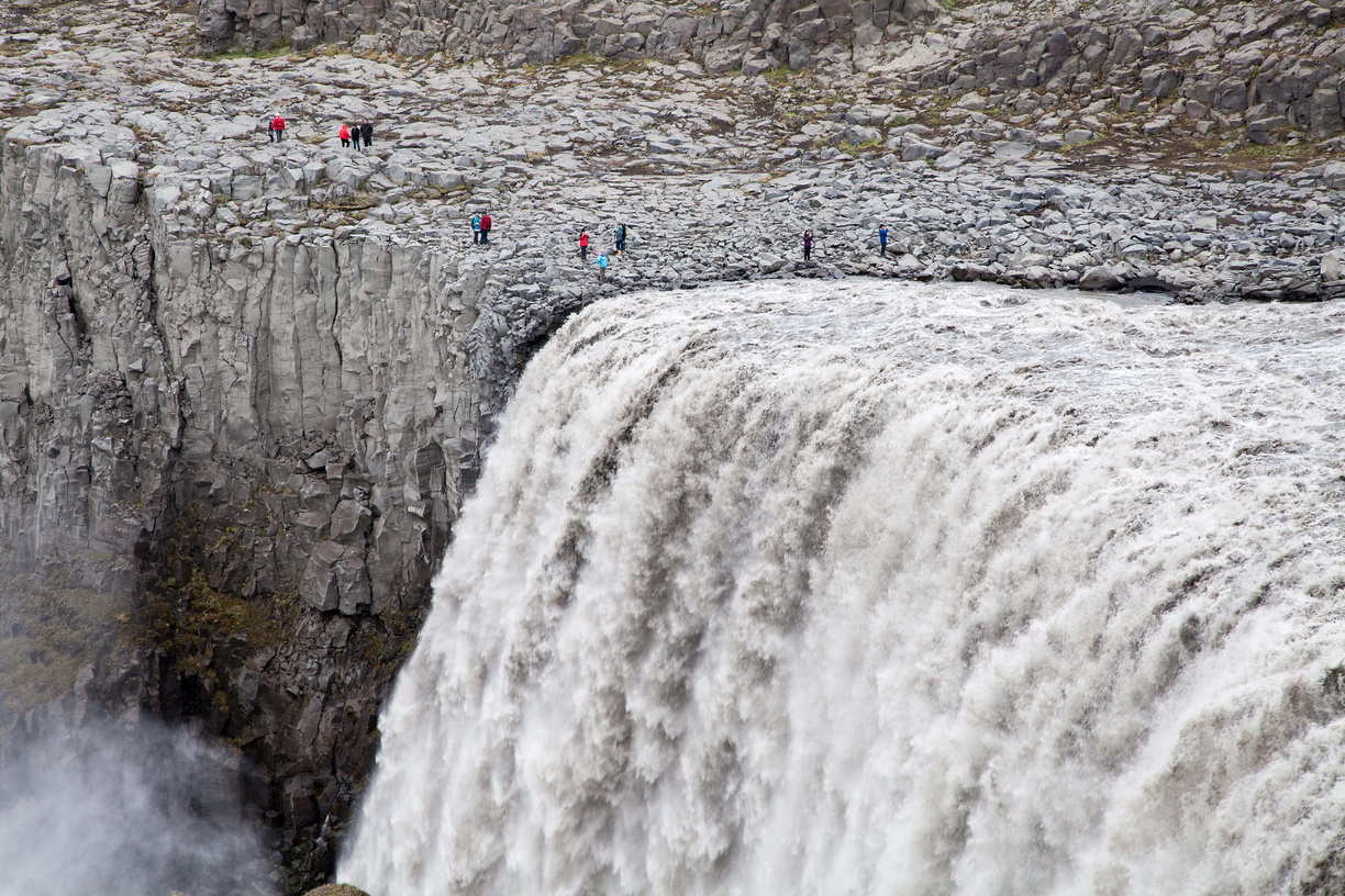 If it looks familiar that’s probably because the opening scene of Prometheus was filmed there (and that’s the only good thing I can say about that movie).
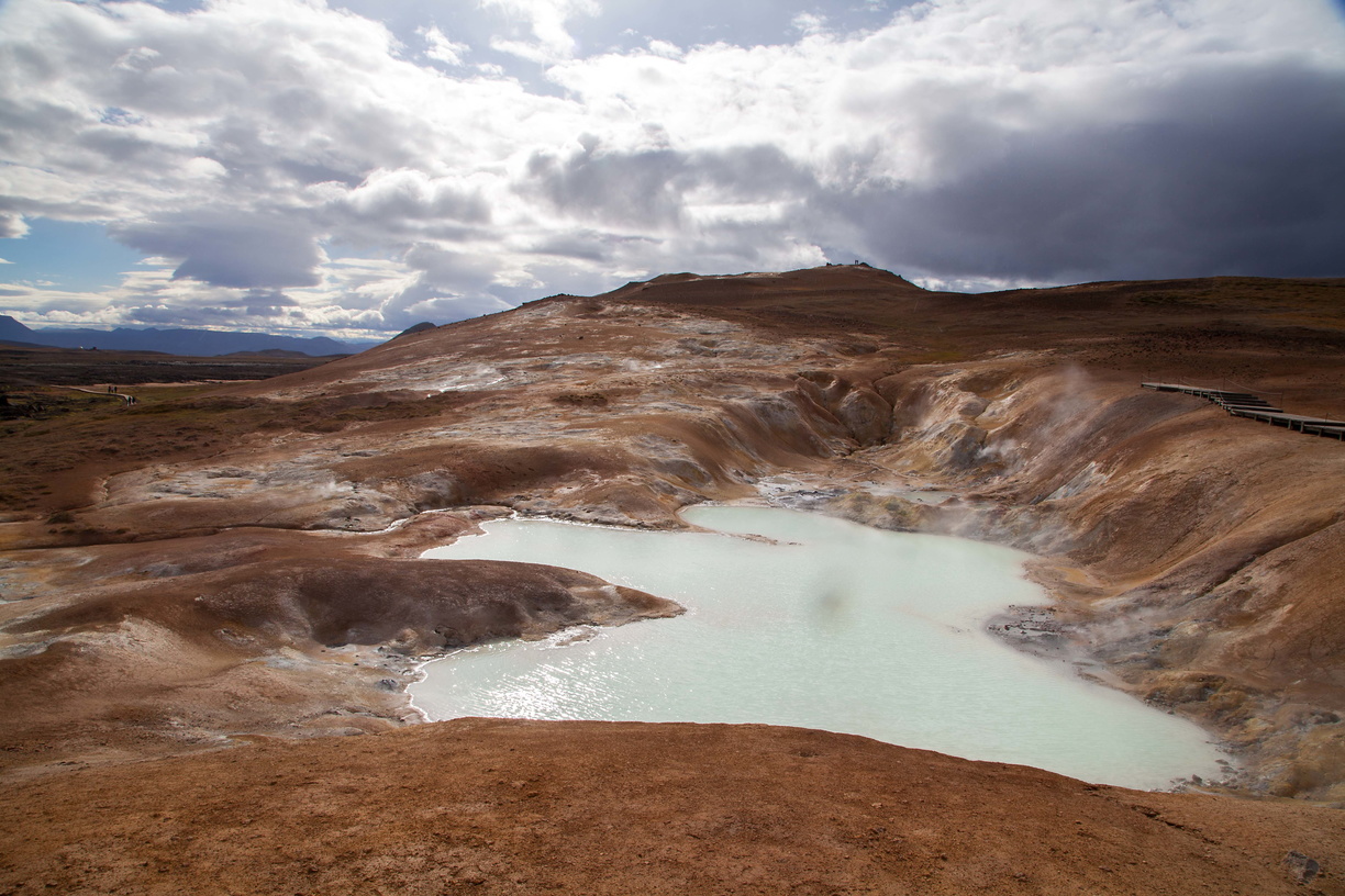
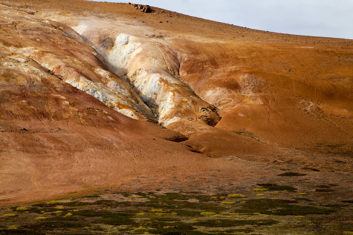
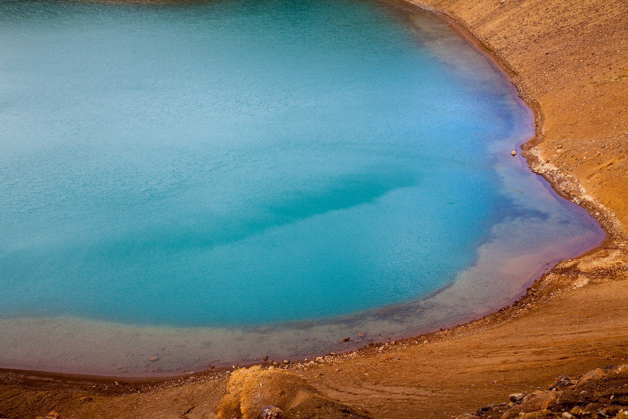
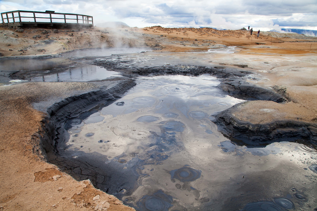
 More fun stuff now: the geothermal power plant of Krafla! Obviously we’re in a geothermal area again and it’s the best in Iceland. You get everything here: lava flows, red, yellow and black earth, boiling turquoise water, craters, steam coming out of the ground. And flies.
 Oh man, the flies… At this time of the year there are millions and millions of them in the Area of Krafla and Myvatn and they just won’t leave you alone. Well, at least they don’t bite but they did ruin some of my pictures. Yes, there were so many of them that I had multiple black spots on my pictures. But don’t let that frighten because Myvatn is really worth seeing.
 But first let’s come back to the power plant for a moment. You see, there’s so much geothermal activity in Iceland that they generate more power than they need. No need for nuclear, coal or gas: geothermal energy is more than enough. Actually they even started producing aluminium, which require a lot of energy, to take advantage of it. The reason for all that activity is that Iceland sits across the divide between the North American and Eurasian tectonic plates.
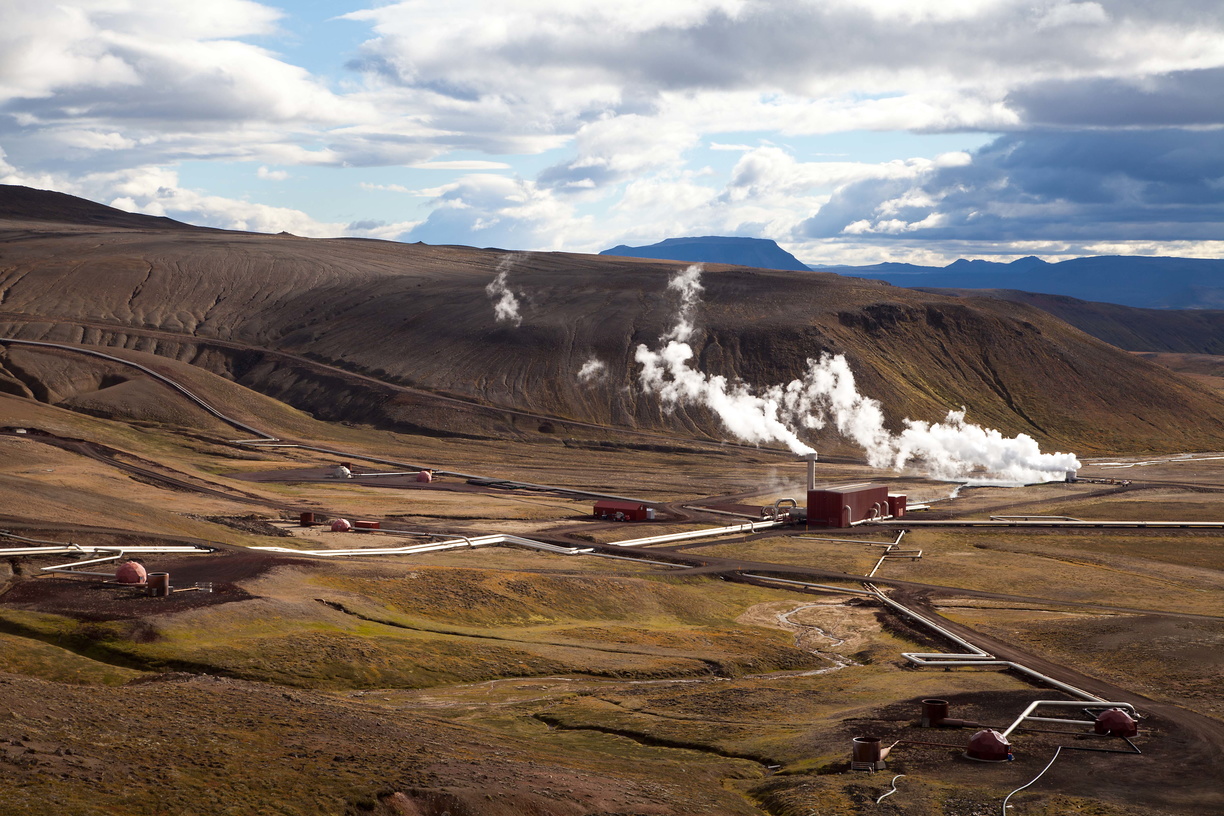 Of course it’s not perfect either: some parts of the power plant have been destroyed by lava flows in the past and had to be rebuilt.
 Remember to watch your step, the ground can get very hot:
 Not joking here:
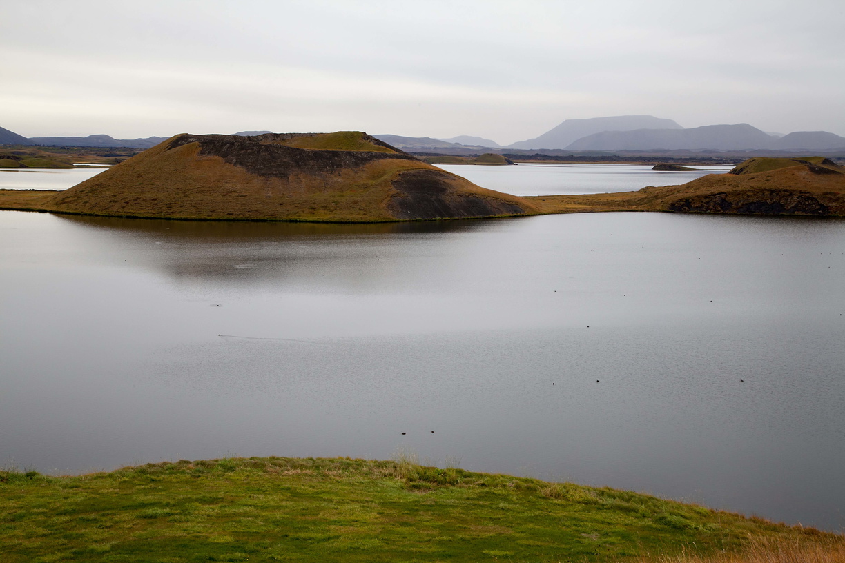
We’re now moving to the nearby area of Myvatn that I mentioned earlier. Myvatn is actually a lake surrounded by a lot of weird, interesting stuff like craters, caves and strange rock formations.
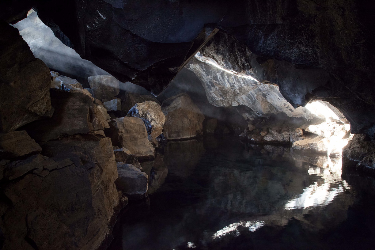 Speaking of caves, here’s Grjotagja with its warm water pool. A scene from Game of Thrones was filmed here (notice a pattern yet?).
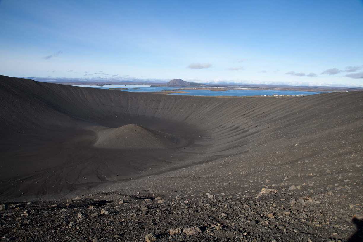 And here’s the Hverfjall crater, overlooking lake Myvatn and the surrounding area.
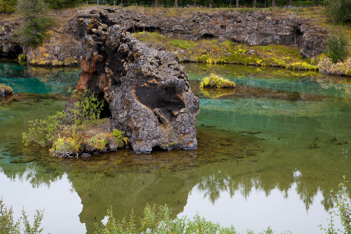
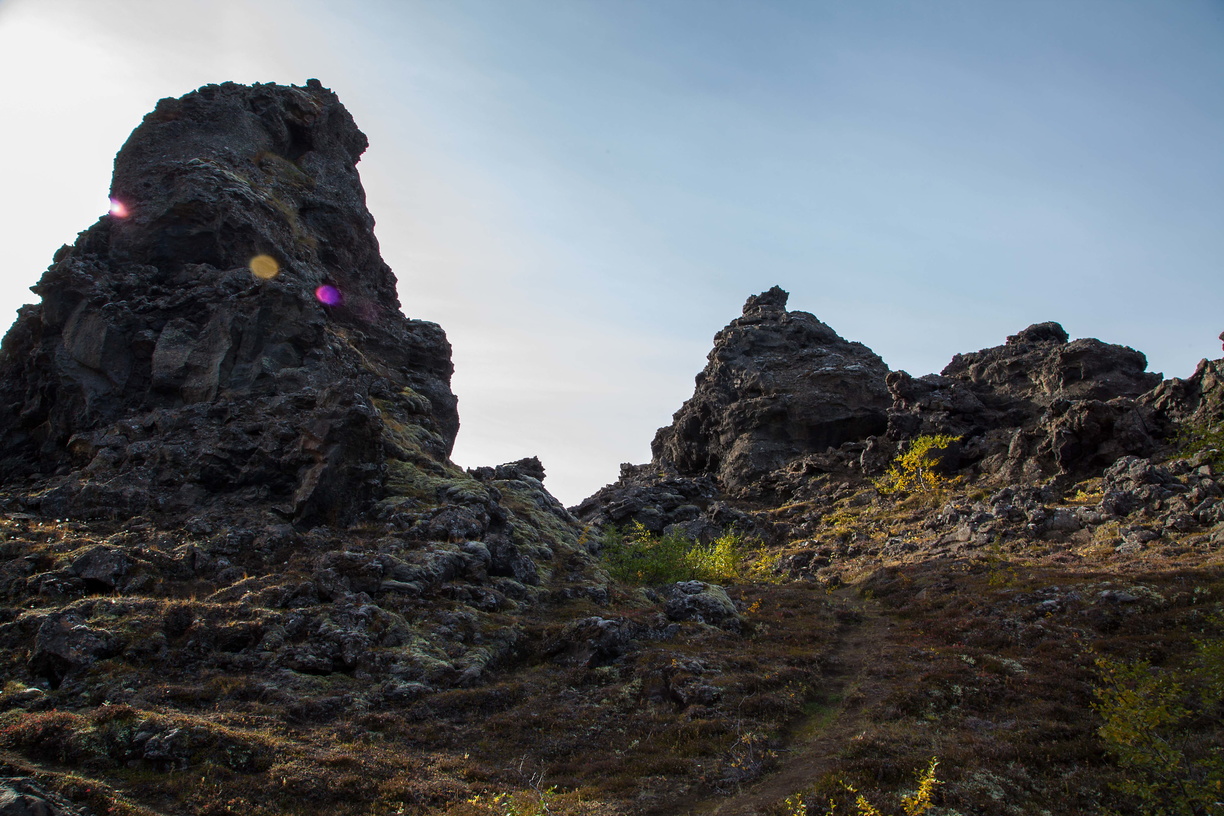 Then we get to Dimmuborgir, a maze-like area full of rock formations made of volcanic stone with all kinds of weird shapes.
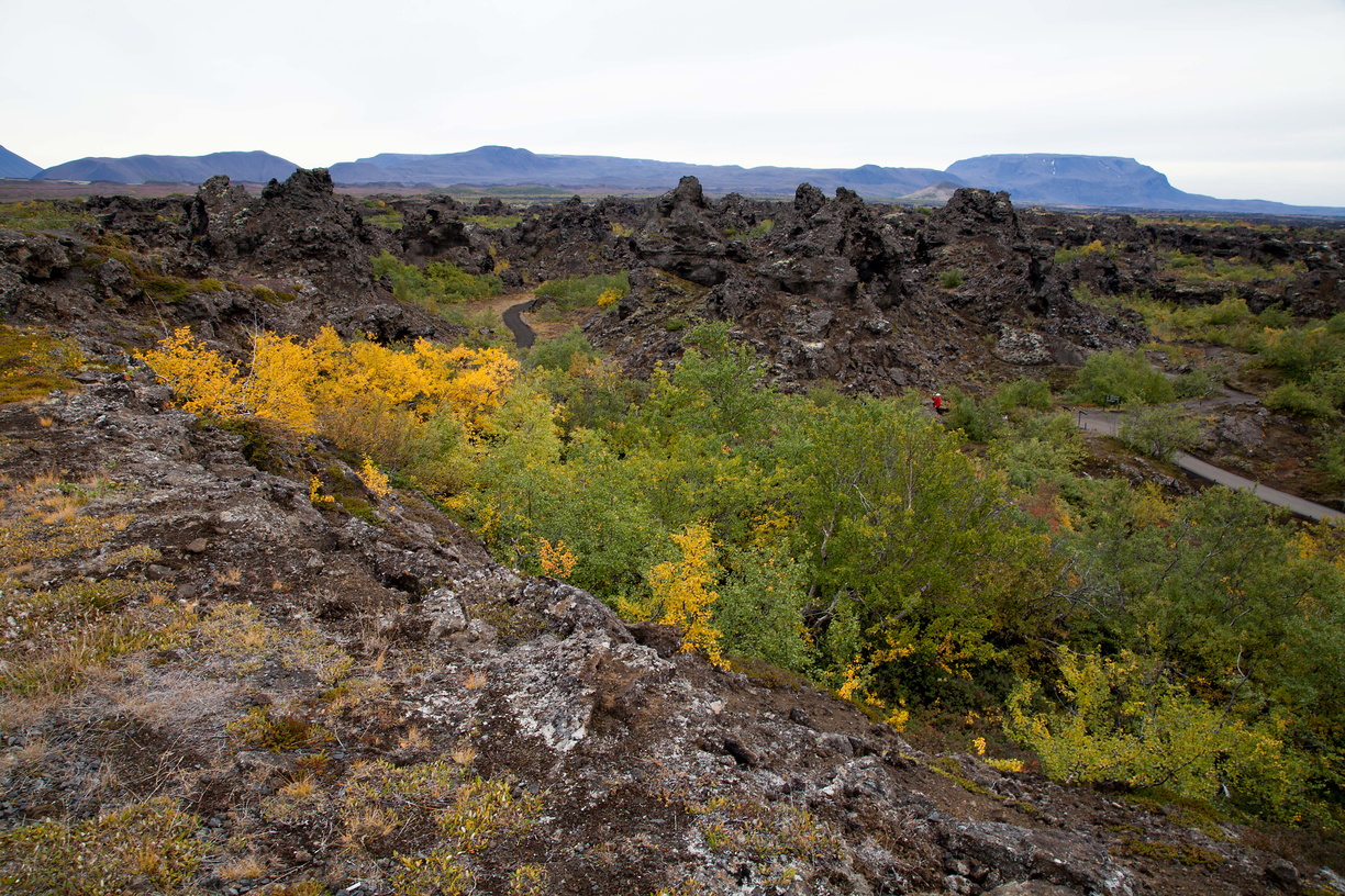 There’s actually quite a lot of vegetation there so it makes a nice colourful combination with all the stones.
 The water offers some nice colours as well:
 We also have the pseudo-craters of Skutustadir:
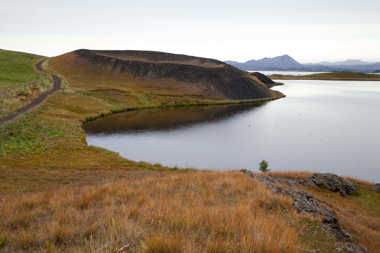 They’re called pseudo-craters because they’re not actually volcanic craters: they were formed by pockets of water that got overheated by magma and exploded, leaving these craters.
 If you’re in the area I highly recommend stopping by the Myvatn Nature Baths. These are nice, open air, geothermal warm baths with a nice view over the area (and less touristy than the Blue Lagoon). The nice thing about geothermal water is that it’s naturally sterile, no need for chloride and other disinfectants, which makes it much better for your skin. It’s also very relaxing when you’ve spent the entire day walking around the Myvatn area.
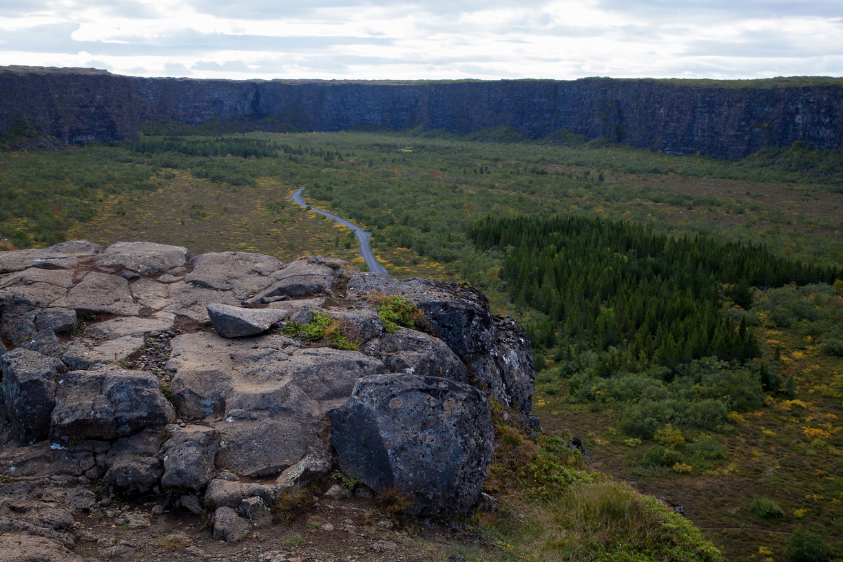
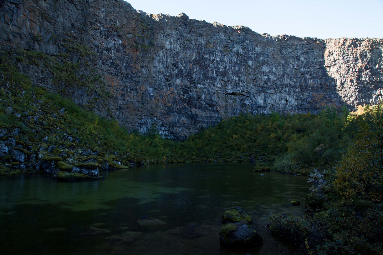 Away from Myvatn, I went to Asbyrgi canyon located in the Vatnajokull National Park. It’s a large horseshoe-shaped canyon and there are trees there, surprisingly!
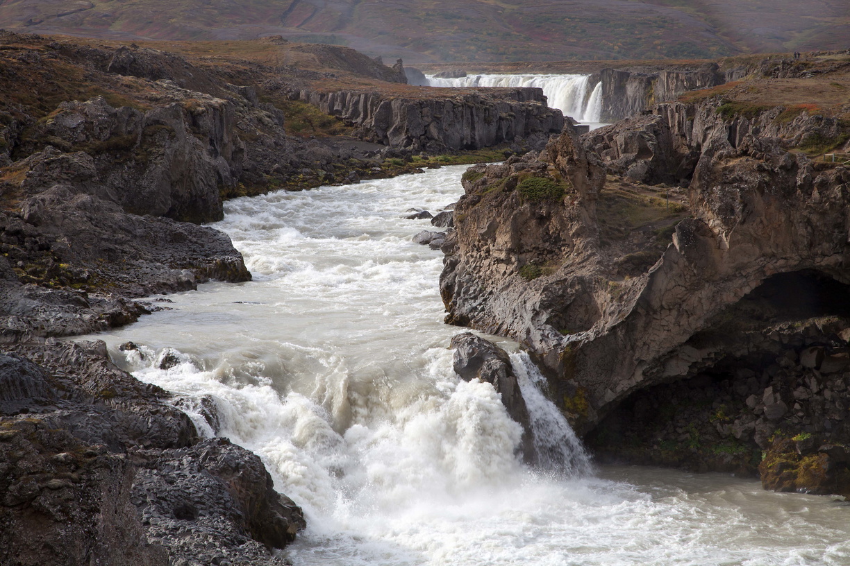
 At this point you could start heading towards the Westfjords but I didn’t have time for that so I headed back towards Reykjavik, with a few more stops on the way such as Godafoss.
 I also came across this lovely church with a classical Icelandic style and the same kind of grass roof that we saw in Norway.
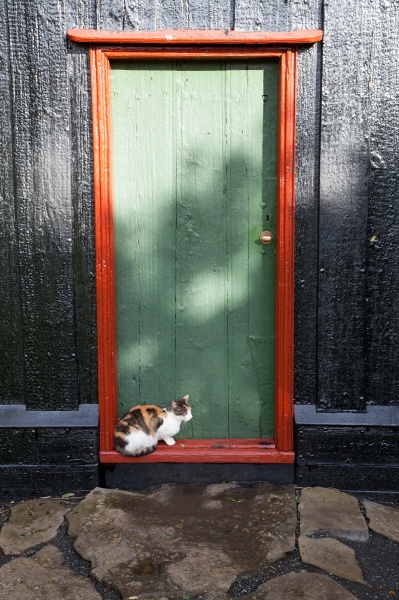
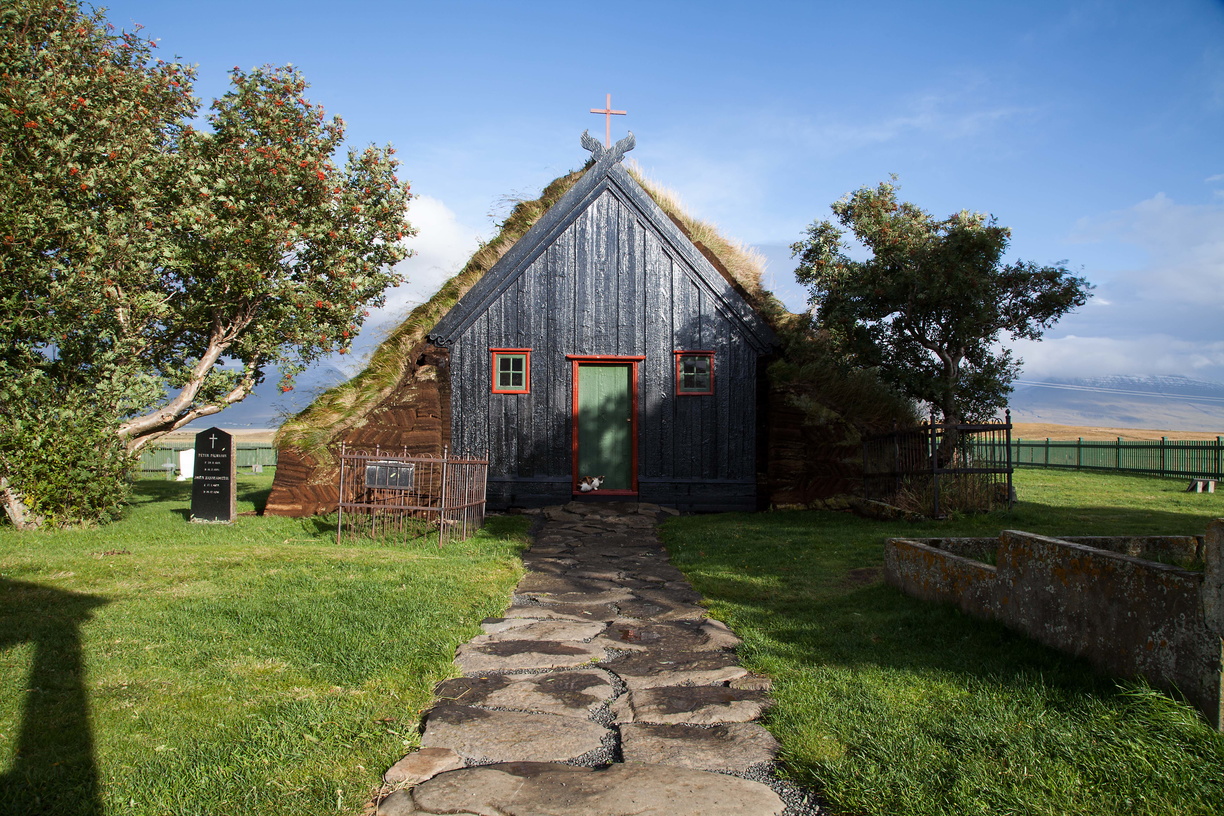 Looks like it has a mascot!
 I was now back in the Reykjavik area but I still had a bit time to see a few more things, such as the Perlan mentioned at the beginning, which contains the Saga Museum:
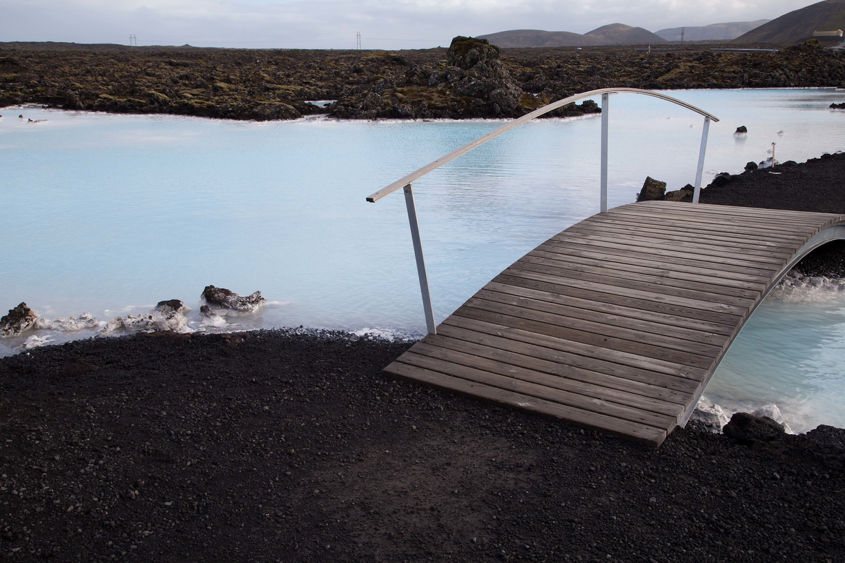
 And a relaxing bath at the Blue Lagoon:
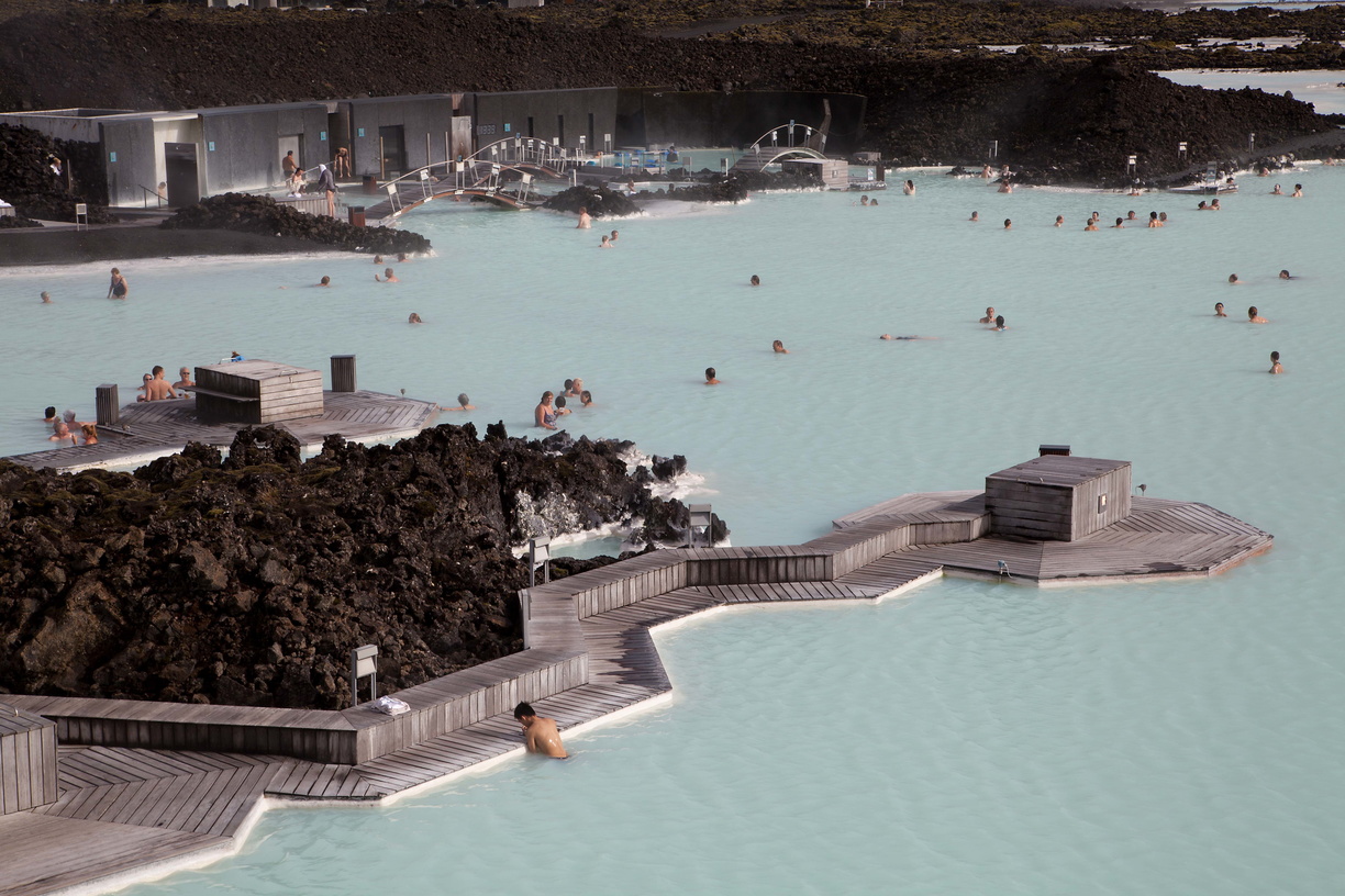 Yes, I did say that it was very touristy and kind of expensive but it is also very beautiful. That being said, if you want the “true Icelandic experience” you should look for one of the old-fashioned hotpots spread across the country.
 And then sadly I had to go back home…
Unfortunately there are still a few things I didn’t have time to see so I’ll certainly go back sometime in the future. I’m thinking mostly of Silfra, Landmannalaugar, the Blue Ice Caves and the Westfjords. If you’re going to Iceland you might want to include these destinations as well!